

Civic & Community
Public Life Study: Professional People-Watching!
Join us! With the Capitol Hill EcoDistrict and the Seattle Department of Transportation, B&V is collaborating on “Public Life Counts!” — a public life study of how our community uses public spaces. Data collected will inform an equitable and holistic planning process to shape active, safe, and well-connected public spaces on Capitol Hill.


October 31, 2019
Join us for a Public Life Study on Capitol Hill!
As members of the Capitol Hill community and advocates for great design, we value the public realm and the impact our public spaces have on creating and sustaining our quality of life. Our consistent engagement with the neighborhood has led to an exciting collaboration with the Capitol Hill EcoDistrict and Seattle Department of Transportation.
We have been selected to perform a public life study on Capitol Hill to support the EcoDistrict’s funding application for an intensive, community-centered public life planning effort in 2020. Essentially, we get to people-watch as part of a city planning initiative!
What do terms like “public life” and “public realm” mean, you may ask? And, how do we study it? Read on to find out!
What is ‘public life’ and why is it important?
Public life refers to the time we spend and the activities we engage in when in the public realm. Be it commuting, dining, relaxing, exercising, playing, or just walking and biking around, public life occurs in all cities and towns. When we talk about the public realm, we’re referring to all the open spaces between buildings: the streets, sidewalks, plazas, parks, and rights-of-way that are accessible to everyone and activated by the everyday use of residents and visitors.
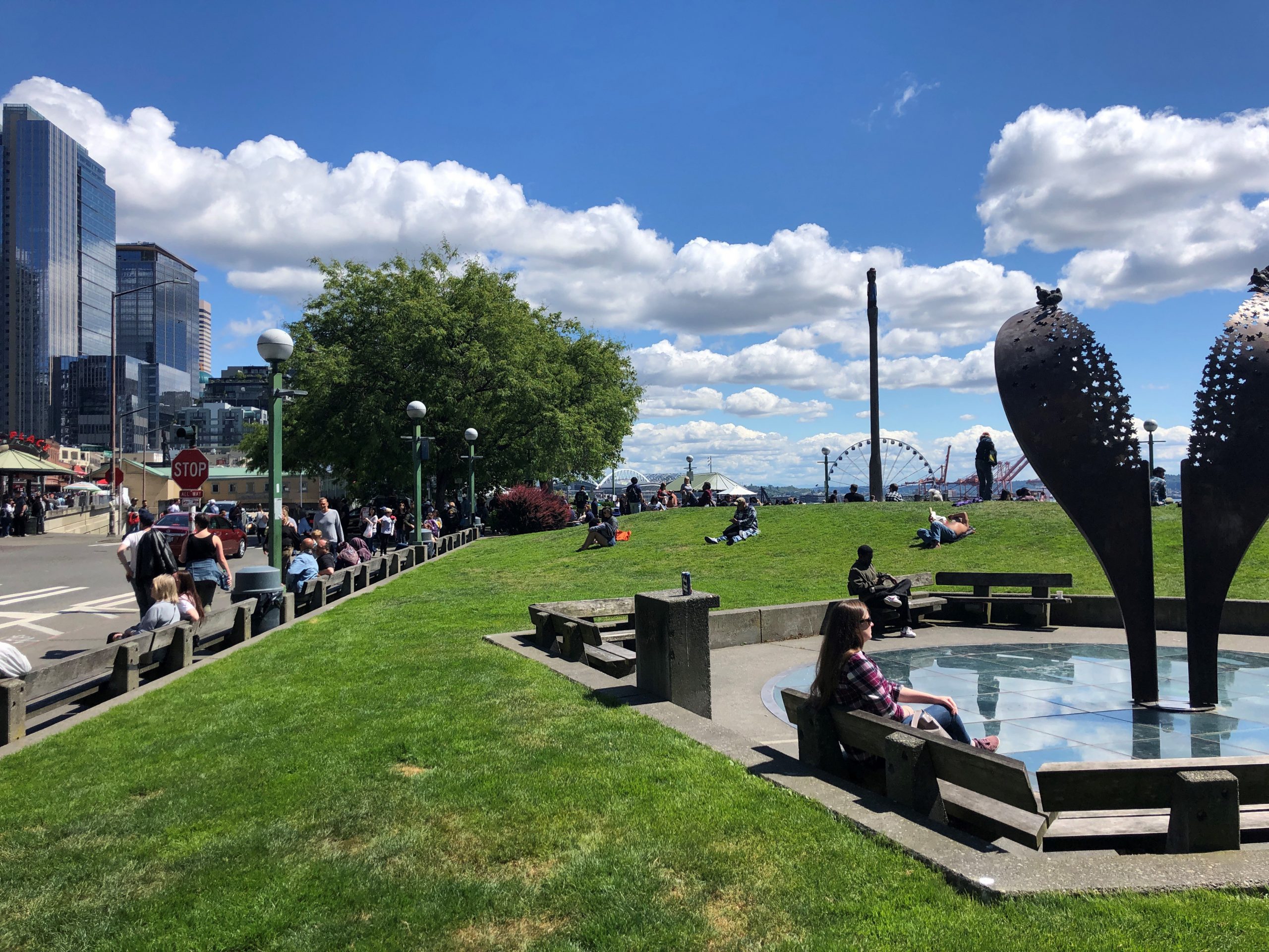
This Is Public Life!
People enjoying the lawn, benches, sculpture and view at Victor Steinbrueck Park on a sunny day — this is public life!
Public life is important for several reasons. Feeling welcome in the public realm creates a sense of belonging and helps build community ties and social capital. Creating an equitable public realm also helps us lift up all members of our communities, giving every member of the neighborhood a place to spend time outdoors, recreate, or just relax.
Public life also supports safety in the public realm. Author and urban activist Jane Jacobs first coined the term “eyes on the street” in the 1960s, referring to the ability of a neighborhood to physically look out for its residents’ safety and well-being. Her use of the phrase not only applies to visibility and safety through environmental design, but it also describes the presence of people occupying the public realm — spaces like stoops, sidewalks and public plazas — in a range of uses throughout the day and night.
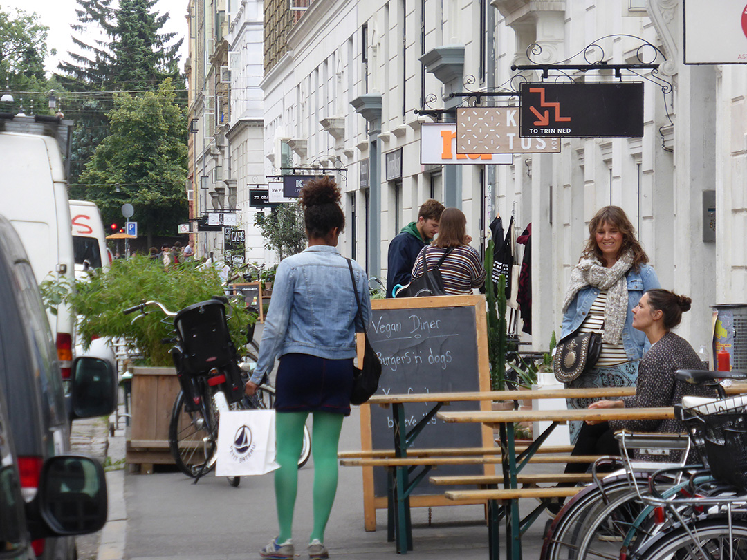
The Public Realm
Public life is created in all public spaces, not just parks and plazas — storefronts, sidewalks, and streetscapes also contribute to a robust public realm. Photo Credit: Jim Nicholls.
A healthy public realm provides space for all people, residents and visitors alike, and invites people to linger by creating a safe and accessible place to be in public. Enjoyment of the public realm ultimately encourages people to take ownership of that space and protect it from negative uses. Supporting public life creates well-occupied public spaces that put people first, prioritizing enjoyment, social wellbeing, and safety.
Why study public life, and how do you measure it?
Let’s think about a city street for a moment. Imagine walking down a street where the sidewalk is a narrow passage along a blank building façade. There is little buffer from car traffic going 40 miles per hour, and the sidewalk is cracked and difficult to navigate. The lack of trees and protection from the elements leave you feeling exposed and tired. Trash builds up against the building wall because no trash cans line the street. You feel compelled to move through this space quickly, as it is uncomfortable and bleak. It is unlikely you will find people stopping to spend time on this street and local businesses are likely struggling or transient.
You walk a few more blocks and turn the corner. Wide sidewalks with planted buffers run parallel to a protected bike lane and on-street parking. The speed limit is 25 miles per hour, and cars slow down. Sturdy street furniture and trees line the walkways, where outdoor café seating is scattered among open storefront windows. Smells and colors from local shops fill your senses as you walk along. You see your friend duck into a nearby café for a coffee and you stop for a moment to chat. The design of this space compels passers-by to stop and linger within the public realm.
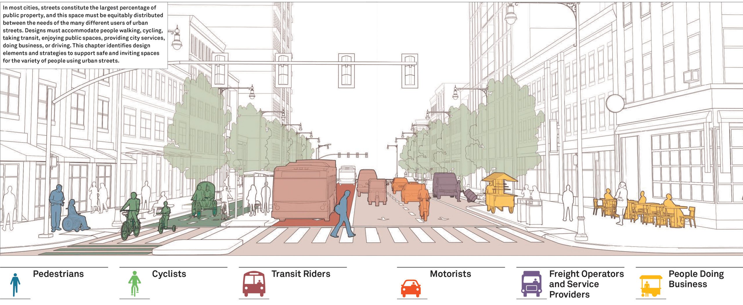
Street Users
The character of our streets, sidewalks, crosswalks, and multi-modal transit facilities impact the way we live our everyday lives, public safety, and ultimately our ability to enjoy the public realm. Image Credit: NACTO Global Street Design Guidelines.
Good public space is created when the public realm is designed thoughtfully with human-scale elements that respond to the surrounding community's needs and preferences. To do this, we need to study and observe patterns of public life to help inform future design decisions. Studying public life at varied times throughout the week and weekends can lead to some compelling metrics. These metrics help planners and designers better understand how people use the public realm and provide valuable insight into community preferences and habits of behavior. The metrics are most valuable for informing future design and planning decisions that enrich the urban fabric through equitable public space design.
Studying public life isn’t a new practice; cities around the world have been exploring methods for gathering data and implementing their findings through the planning process for decades. Spearheaded by Jan Gehl of Gehl Architects in the 1960s, the goal of studying public life is to collect both qualitative and quantitative data to inform planning and urban design for how people live and to implement designs that put people first.
For our project, we will implement the public life data collection protocol established by the Gehl Institute, and adapted for Seattle by the Seattle Department of Transportation (SDOT), to compile data about public life on Capitol Hill. In order to enhance our existing public realm and create great public spaces for our community in the future, we need to find out how people are using the public realm today. Methods for data collection include counting pedestrians moving through spaces, along with people staying still in the public realm, at different times of day.
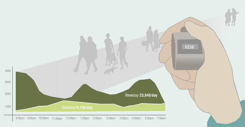
People-Watching for the Public Good
Collecting data on public life is like next-level people watching: fun and functional. Public life data informs strategic planning and design for our public realm.
Have you ever enjoyed “people-watching” while waiting for transit or sitting in the park? Public life data collection takes people-watching to the next level. We will be documenting the number of people, group size, approximate age range, and activity of people passing through or staying in the public realm across Capitol Hill. More detailed observations, like weather conditions, availability of public seating, protection from the weather, and adjacent activities will also be documented to add a qualitative layer to our data that will increase our understanding of how existing spaces are functioning.
Why now?
Working with the Gehl Institute, the City of Copenhagen, and the City of San Francisco, the Seattle Department of Transportation (SDOT) developed Public Life Data Protocol that is adaptable to a range of public life studies and research questions. As part of this effort, SDOT created a user-friendly guide for public life data collection available for use by any person or organization. Coupling established data collection guidelines with grants from municipal organizations, like the Department of Neighborhoods, and other local non-profits, we now have the opportunity to support a ground-up planning process for our neighborhoods.
While previous planning efforts have tended toward high-level, municipally-generated policy, residents now have the tools to study and inform the design of public space. This ground-up approach is an important aspect of community-centered design and is the core of our Public Life Study for the EcoDistrict.
So, we end with the question: how can we direct future development toward people-centered spaces?
The answer: data-driven design that puts humans and communities first. By studying how community members are using the public realm, we can design and plan in a manner that conserves, accommodates, and enhances those uses over time.
Want to people watch with us?!
Please do! Register here for a volunteer shift on November 5th or November 9th. Volunteers will receive data collection training at the beginning of each shift, and worksheets to record data. Each volunteer will cover up to four spots in a two-hour timeframe, recording either “staying” and “moving” counts in 10-minute increments before rotating to the next spot. Volunteers will be collecting data in pairs and each data collection spot will be within walking distance so that each pair of volunteers can cover a small area within a three-to-four-block radius. Volunteer shifts will be about 3 hours long including time to meet-up, receive hands-on training, and breaks between each collection spot.
Can’t make it on the dates we are collecting data but want to get involved? Email [email protected] for more information, or to keep up-to-date as our project progresses.

