

Layering of Space
The backyard oasis is comprised of layered spaces and programs — framed by the new garage and studio, and the main house. Backyard Artist Studio | Photo by Meghan Montgomery
Custom Residential, Landscape Architecture
Using Drones for Site Planning
You’ve probably heard of drone technology — but did you know it can be an effective tool for design projects? We’re breaking down all the ways drone technology can improve your project, create efficiencies, and help you collaborate with your design team.

May 2, 2024
Our design team approaches projects carefully and with a variety of tools to ensure we have the right information to create great design solutions. For the past few years, we have been using drones for site planning to map out projects and create 3D visuals of project sites.
This high-powered technology has proven to be highly effective and a great tool to help with collaboration between the design team and the clients.
What is drone technology?
Let’s start with the basics. The drone we use flies above your property and generates a 3D model of your site using photography and Artificial Intelligence (AI). This footage is then uploaded into a software called DroneDeploy. This software allows our team to create nearly perfect, real-time mapping of your site.
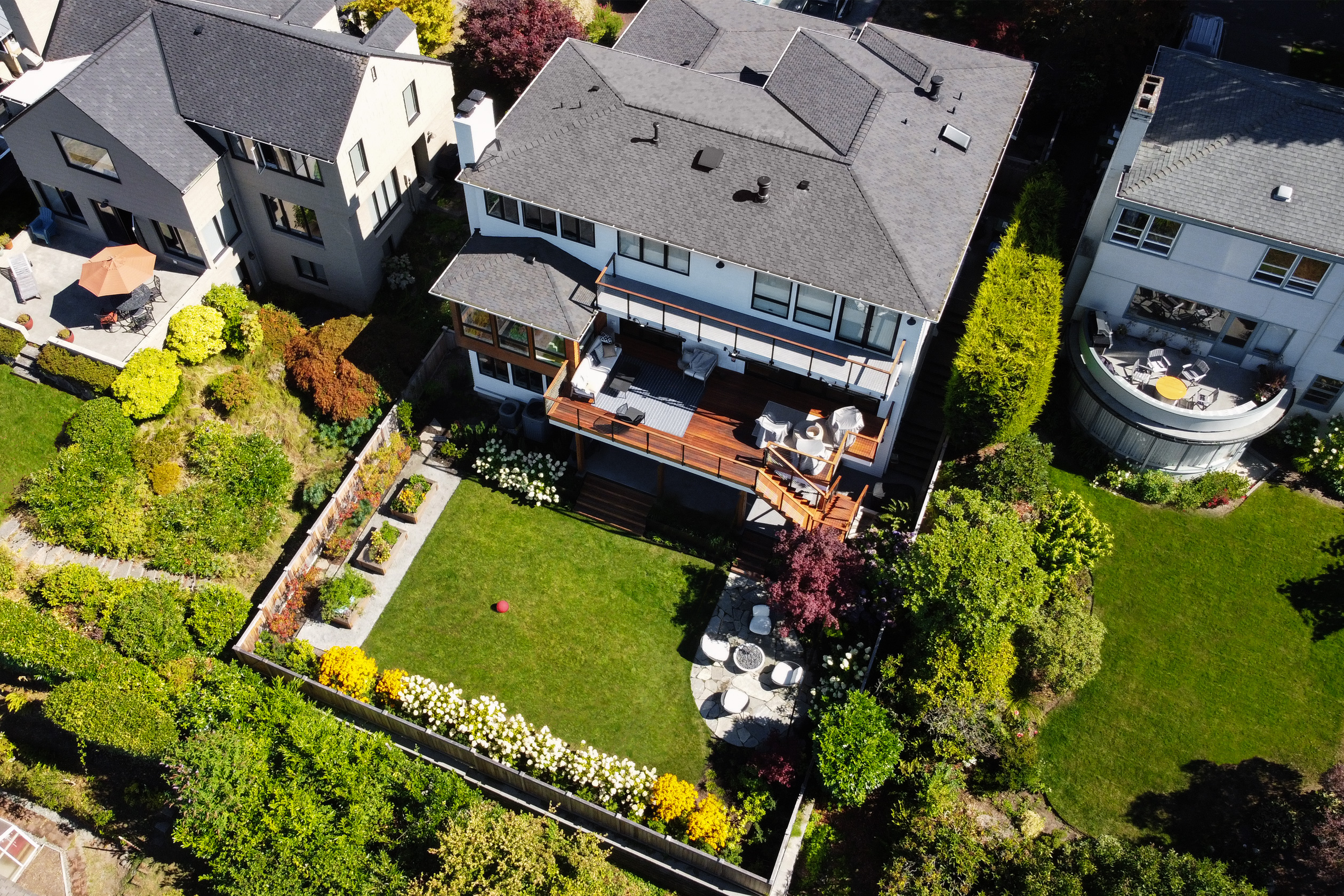
A Higher View
Drone technology allows your design team to get a big-picture overview of your property.
DroneDeploy gives our landscape architects and all the members of our design teams technical insight into your site’s measurements, topography, positioning, and other key details that can only be otherwise obtained by a survey. (Though it can’t replace a survey if your project needs one. But more on that later.)
It also captures 3D views of any buildings on your site, ensuring that we have excellent documentation of existing conditions. This is especially helpful when designing second homes or vacation properties where the site is far from our Seattle office.
What’s the point of using drone technology to map my site?
Using drones for site planning comes with many benefits. It provides our team with a highly accurate mapping of the details, nooks, crannies, elevations, contours, and nuances of your property.
While we are designing and collaborating on different solutions for your site, having the 3D map of your property is a useful resource that we can refer to to ensure we have a holistic view. It is an efficient tool which can save time on your project.
Survey Substitute
As long as your project doesn’t require any special permitting — like you might need if you were digging an in-ground pool or another similarly large change — information acquired from the drone we fly can be used to inform updates to your property without the need for a survey. This can save precious time on your project.
If you need a survey, you need one. But since surveys can be time consuming, if we can get the information we need by an easier means, it better serves the project and you, the client.
As-Built Measurement Ease
The measurements and information obtained by a survey are called ‘as-builts’ or ‘as-built measurements’ – a term you’ll hear frequently in the early stages of your project.
As-built measurements encompass all the key details and information of what currently exists on your site to provide the groundwork for what’s possible. For the right project, drones can capture this information quickly and efficiently without the need for a lengthy surveying and measuring process.
Is drone technology right for my project?
As mentioned, if your project doesn’t require any special permits, a drone is a great option to help move your project along without the need for a survey. But, even if your project does require permits, it can still benefit from drone footage and mapping.
Drone mapping is an important step in ensuring we have the best possible record of your site. It allows us to visualize your site in ways we otherwise wouldn’t be able to. Having this record of your property makes our role much easier, quicker, and more efficient.
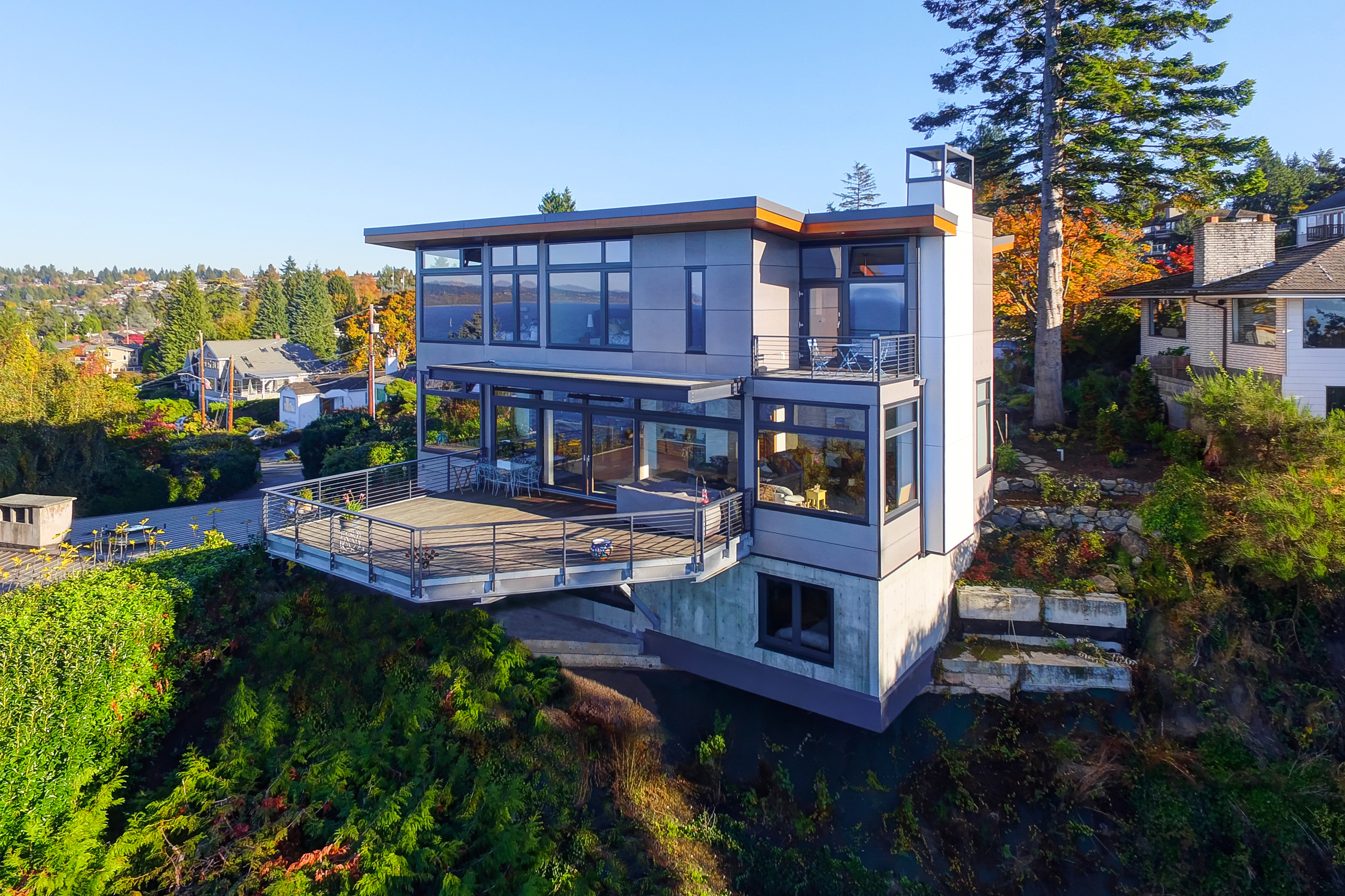
Up Above
Using drone technology for site planning allows us to see your site from otherwise inaccessible heights.
Drone technology gives also gives a client the opportunity to visualize their property in ways they’ve never seen before. For example, our site design team frequently uncovers misalignments or crookedness in fences, hedges, and landscaping perimeters and lines that can only be spotted from an arial vantage point.
But there are numerous benefits that drone technology allows us to tap into, even beyond site and landscape design. If you’re considering adding an additional story onto your home, we can use our drones to uncover what your new views will look like, how high we can build, and other crucial elements of architectural builds.
We’ve flown the drone. Now what?
After we’ve used the drone to acquire the as-built measurements of your site, we’ll upload the footage into DroneDeploy. This generates an interactive map of your site, kind of similar to what you see on Google Maps.
From here, our design team will have everything needed to begin planning and creating design solutions for your project. The drone footage serves as a visual reference that can be accessed at any point to revisit measurements, topography, vegetation — any detail crucial to planning out your new site.
As a firm, we continually pursue and use advanced technology to help us do our jobs better and convey our design intent to our clients. Using drones for site planning is just one example of a tool we have found invaluable in conveying design intent. And getting clients excited about what is next!


